Republished with permission from:Richland-Wilkin Joint Powers Authority
Original Publication Date: August 1st, 2013
Wahpeton Daily News
Republished with permission from:
Editorial Team, Richland Wilkin Joint Powers Authority
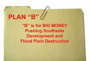
The FM Diversion Authority’s hired gun says they have a backup plan. The Diversion Authority’s project management company said they can build the mammoth project piece by piece, without the federal government. The catch is that they may not build all the pieces.
Rumors of the federal government-free diversion have been around since last winter’s North Dakota legislative session.
The first piece is to build the outlet on the north end to drain the flood plain north of Fargo. The second piece would be to build the dam and reservoir on the south end, so they can back up water south of town. This explains why the Diversion Authority is so anxious to build their monumental ring dike around Hickson, Oxbow and Bakke. If Congress never appropriates federal dollars for the project, the diversion channel on the west side of Horace and West Fargo wouldn’t be built. The four massive river crossings wouldn’t be built. Fargo would hold water behind the dam twice as long, and let it drain slowly through town instead of making it travel around the city. This “backup plan” makes a bad situation upstream worse.
Where is all the water going to go that used to occupy the flood plain north of Fargo?
Downstream.
Has anyone asked their opinion?
The Corps is required by law to estimate the effects in the Environmental Impact Statement. We’re pretty sure they didn’t. What about the people upstream? Diversion Authority Chairman Darrell Vanyo said water will be stored behind the dam for 5 1/2 days. No one has explained how you can accumulate and drain 200,000 acres-feet of water in that amount of time, without washing out every township road in the 50,000 acre pool.
If you double the time you store the water, how much will it delay, or prevent farmers from getting to their fields?
How will it affect the basements and septic systems of the residents of Hickson and Bakke?
Normally, the Red River rises slowly in spring flooding and loss of life is not an issue, even in the worst flood. But if 200,000 acres-feet of water are going to be held behind a high hazard dam south of Fargo for a couple of weeks, not to mention the massive ring dike around Hickson, Oxbow and Bakke, what’s the loss-of-life calculation then?
Won’t the DNR be interested in the environmental impacts?
The Corps stated in their study, that they couldn’t hold any more water, for any longer, because of fish passage impacts. These issues don’t simply go away because Fargo wants to get moving on a project that the federal government will likely never fund, even if they can bully the North Dakota Legislature into paying for it.
Fargo needs plan C: Quit building in the floodplain. Build your dikes to 43.5 feet and get out of FEMA insurance requirements. Invest in basinwide retention to give protection beyond the 100-year flood level. Moorhead should be congratulated for getting their city safe from spring floods.
Fargo should take a lesson from their smaller sister.
Views: 130
