Richland-Wilkin Joint Powers Authority
Original Publication Date: May 31st, 2012
Republished with persmission from: Wahpeton Daily News
The Fargo Moorhead Diversion Authority and its agent, the U.S. Army Corps of Engineers, continue to obscure the truth about the plan to dam our rivers and flood our farms and communities.
Despite their response, several things remain clear: View Response
• Early on, Fargo-Moorhead and the Corps did a benefit/cost analysis and determined that the FEMA flood plain levels do not justify the expense or the need for the project. F-M is and will be protected from flooding to nearly 43 feet and thus have little to fear from either a 100-or 500-year flood. The only way the Corps could justify their fees, and Fargo to get expansion room, was to create a threat; manufacture a crises by raising the numbers. They employed their “non-traditional hydrological method” to raise the flood plain numbers by three feet. They did this by discounting all the dry years prior to 1942 to inflate their average, then hired a few “experts” that agreed with them.
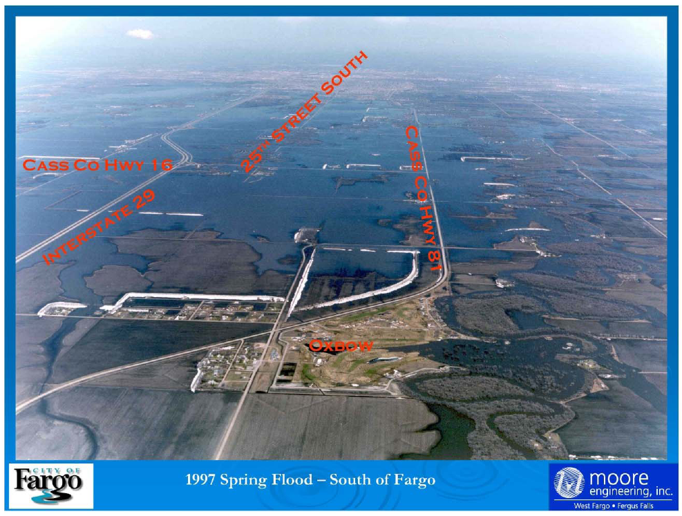
• At the height of the 2009 flood, the Red River in Fargo was transporting 29,500 cubic feet/second (cfs) of water through the city. According to the Corps, a flood plain level of 46.7 feet assumes that more than 61,700 (cfs) would flow through the city at the moment of its crest. This is more than twice the flow of the river during the 2009 crest, the greatest flood in recorded history. Unless you’re “Noah,” it’s hard to imagine a weather scenario that would create such a huge volume of water in the upper Red River Valley Basin.
• The Corps also tries to sell this as something that “does not translate to other cities along the Red River . . . isn’t necessarily transferable to any other place.” It appears that Fargo and the Corps are pushing these numbers to justify the dam/diversion, but fear the repercussions of requiring everyone from Wahpeton to Pembina to be required to buy flood insurance. Imagine a mound of water measuring 45 feet at the Fargo gauge, this water would certainly flow north through Grand Forks and be transferable up and down the valley. It’s hard to visualize water flowing at the twice the rate of the 2009 flood “not transferable to any other place.”
• By employing sound hydrological principles, FEMA establishes the federal flood plain level for virtually every community in the nation. The FEMA numbers, past and future, do not agree with the numbers Fargo-Moorhead and the Corps are trying to sell. The proposed 100-year flood plain according to FEMA, employing recognized, proven hydrological methods, is 39.5 feet, not 42.4.
Views: 110