Continued from:
Part 1 – Exposing the FMDA and USACE
Part 2 – Exposing the FMDA and USACE
Fear Mongering is the tool of choice for the FMDA (Fargo Moorhead Diversion Authority) and USACE (US Army Corps of Engineers.
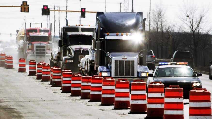
Wailing sirens and police escorts for sandbags that would never see a drop of water was the message in April 2013 as the North Dakota legislature drew to a close. The big show for big dollars as the “little boys” cried wolf.
Seems preposterous, but the FMDA cult has a myopic message that you will suffer and could die if the diversion isn’t built.
100 PERCENT GRADE A “B.S.”!

Let go of any pre-conceived notion for or against the metro area flooding and listen to this audio clip of a Diversion Authority Public Outreach meeting.
Doesn’t it shock the senses when Rodger Olsen (Cass County Joint Water Resource District Manager) and Rocky Schneider (AE2S) openly assert that the flood insurance threat is their best conduit for positive outrage.
Then Kevin Fisher, a “Director” of the Fargo Moorhead Area Association of Realtors slyly suggests that homeowners need to be shocked into calling the people to be and let’s get it done.
Do these people possess a moral compass?
Why does it seem like a majority of elected or appointed public servants lose the ability to listen and feel they are entitled to impose their agenda?
December 10th, 2014 Public Outreach Transcript Excerpt
| Rodger Olsen: | but the in…, insurance threat might be our…, conduit to…, continuing this forward, and, and giving us the support that we, y’know, we’re looking for. |
| Rocky Schneider: | I think like you said, I think there’ll be, there…there… y’know positive outrage once those letters come out about… Why am getting this letter? Why hasn’t something been done? I think this is a positive thing because I think that’s… that’s what everyone’s working toward. |
| Kevin Fisher: | especially when we get that homeowner that all of the sudden is being transferred to wherever and has got to sell their house and they didn’t take out the flood insurance…, now they try to sell it and they are like “what!-?” how come I didn’t that’s what this is going to cost ya…, and it’s like well…, y’know…, call the people to be and let’s get it done. |
The threat doesn’t have to be real, just “plausible”. Season it with some “positive outrage”, incrementally increase the threat with a “doomsday” on the horizon and let irrational vulnerabilities take over. The “threat” becomes the essence of the story because it conveniently ties the components of the story together and hysterical rants about “sandbag central” does the rest.
That being said, now is a good time to reflect on an excerpt of GAO (General Accountability Office) testimony from 2006:
| “…planning studies conducted by the Corps were fraught with errors, mistakes, and miscalculations, and used invalid assumptions… …the Corps’ studies understated costs and overstated benefits, and therefore did not provide a reasonable basis for decision-making….” |
The entire FMDA project is a sham (Read More…). This is not a matter of opinion, it is a matter of “fact”.
Let’s look at the facts. The USACE clearly stated in their reports:
| Cited Source | Excerpt from Report |
| 4.4 PHASE 1 CONCLUSIONS | The preliminary study found that a levee system would cost approximately $625 million and have a benefit/cost ratio (BCR) of 1.0. The preliminary diversion concept without a control structure was estimated to cost $909 million and have a BCR of 0.65. The preliminary economic analyses estimated expected average annual flood damages at more than $64 million, with single event damages ranging from $2.1 billion for a 1-percent chance event to $6.6 billion for a 0.2-percent chance event. On the basis of the preliminary findings, the non-federal sponsors elected to continue the feasibility study.. |
| Cited Source | Excerpt from Report |
| FEIS Section 3.4.7.3.1 | The initial diversion concept presented in May 2009 was a passive diversion channel without an operable river control structure; this concept was not economically justified with a benefit to cost ratio of approximately 0.65. All of the subsequent diversion concepts included a river control structure that dramatically improved performance with a modest increase in cost. Therefore, no diversion alternatives lacking a control structure were carried forward. |
So in 2008-2009 a levee system would have been cheaper and met the benefit/cost ratio (BCR) of 1.0. Of which, a majority has since been built in the form of permanent internal flood walls and levees since the 2009 flood.
However, Fargo “elite” developers scoffed at the idea and pressed city leaders to expand into a high risk flood plain.
Interesting, not one mention about mandatory flood insurance requirements but the benefit to cost ratio was not acceptable ~ so the USACE, in their “finite” wisdom, chose to add not one, not two – but three Class 1 High Hazard Dams (read more…) to increase the theoretical flood potential for their client the “local sponsor”, then include more structures into the USACE’s falsely represented 100 year flood plain to pump up the potential economic loss, then begin pressing FEMA to adjust the flood plain upward to polarize homeowner support for the FMDA project (read more…), which eventually turned into a DPAC assessment and sales tax extension until 2085.
But that still does not hide the fact that the original diversion concept failed economically and did not include a nearly 12 mile wide earthen dam and 3 Class 1 High Hazard Dam control structures with operable gates.
So how exactly did the project evolve from $625 million to a potential $4 billion dollar boondoggle?
Testimony exchanged in May 2009 between Byron L. Dorgan (ND – US Senator & Congressman) and Colonel Christensen (USACE) during a special hearing before a subcommittee of the US Senate – Appropriations Committee helps illustrate the deception.
| Excerpt from Special Hearing | |
| Senator DORGAN: | I am going to ask Mayor Voxland if he wishes to respond. But Colonel Christensen, would you just tell us when you did the cost-benefit ratios a few moments ago, was that for a 100-year flood or a 500-year flood or some other flood? Tell us what it was you were measuring. |
| Colonel CHRISTENSEN: | I would have to go for a lifeline on that, sir, just to make sure that I am correct, 100 year plus 4 feet. |
| Senator DORGAN: | Pardon me? |
| Colonel CHRISTENSEN: | A 100-year flood plus 4 feet. |
| Senator DORGAN: | Thank you. |
Let that sink in…
On May 27, 2009 – Colonel Christensen admitted during recorded testimony that the diversion channel cost/benefit ratio failed at .65 for a 100 year flood despite having padded their numbers by 4 feet.
When the USACE conducted their economic analysis the FEMA 100 year flood (1 percent) was 38.3 feet, a specific elevation number that the USACE consistently tried to avoid using in several thousand pages of their reports ~ but cryptically referred to as “100 year” or “1 percent” event.
The USACE testified they tampered with the economic analysis and added 4 feet to the 100 year flood event (38.3 feet plus 4 feet = 42.3 feet) and the cost-benefit still FAILED.
It does beg the question, is Fargo as flood prone as the USACE is trying to claim for the client that hired them?
| Excerpt from Special Hearing | |
| Senator CONRAD: | Okay, I just want to end on this note, if I can, with Colonel Christensen, because we know there is one big potential showstopper out there, and that is the cost-benefit ratio and the cost-benefit analysis, because if we don’t achieve that, we can’t achieve Federal funding.So I want to make certain that I understood your earlier answer to Senator Dorgan. With respect to a diversion, your initial indication is that that would have a cost-benefit ratio of 0.65. The combination would be 0.62. Both of those would be far below any cost-benefit ratio that would be acceptable for Federal funding. Isn’t that correct? |
| Colonel CHRISTENSEN: | Yes, sir. |
| Senator CONRAD: | And so, the only option with respect to your initial calculations that would qualify for a Federal project would be the diking approach. |
| Colonel CHRISTENSEN: | As a standalone alternative, yes, sir. |
This is the pivotal point!
In their arrogance, Imperial Fargo and elite developers would not accept permanent internal flood protection for the city that existed. It didn’t fit their land grab agenda, they got greedy…, they wanted more. Even if “MORE”, meant placing the existing city in harms way and property owners in the cross-hairs of mandatory FEMA flood insurance.
The USACE stepped up and suggested an EOE (Expert Opinion Elicitation) to augment the feasibility study in support of the FMDA project.
The USACE lived up to the reputation outlined by the GAO and the Corps cooked the books. They knew they had a government contractor in their back pocket (read more…), that has ghostwritten several documents (read more…) for the USACE, to serve as the technical integrator and facilitator of the EOE (read more…) held September 28-29, 2009.
Bad Data In…, Bad Data Out…
The EOE used invalid assumptions, overstated flood damages (read more…) and overstated CFS flows to provide the illusion of credibility that the USACE and FMDA were seeking.
It seems rather convenient that the data used to calculate flows is not consistent with the USGS data from 1942 to 2009, averaging an overstated CFS of 22.81 percent. [Click Here to View Comparison]
With a nice tidy bow tied around the EOE and the puffery of the Value Engineering study, the local sponsor (Fargo) felt emboldened with the prospects of Federal Funding and continued city expansion.
| Cited Source | Excerpt from Report |
| FEIS Page 298-299 Appendix O | The ND alignment is a locally preferred alignment and therefore they [Fargo] chose the general location for the inlet. Their reasoning for the location of the inlet being further South than the MN alignment was to accommodate the city of Fargo’s current future plans of development and to protect the city from the Wild Rice River flooding to the South. |
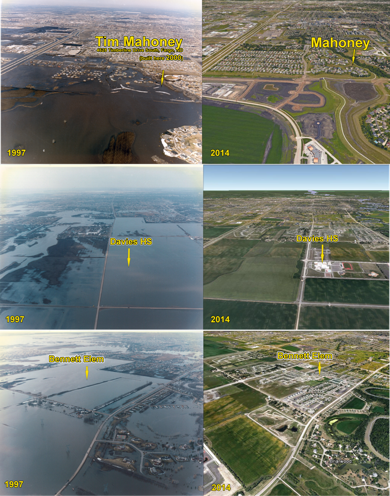
The Fargo school board went “rogue” and rushed to break ground on Fargo Davies in the middle of a known flood plain, despite the location being flooded in 2009. City planners knew it would drive development further south – ignoring the net effect of more water displacement, greater flood risk and an attempted emotional backstory of “deserving” to grow. Fargo pushed its southern border 5 miles further south into a flood plain that, that will increase the flood risk to Fargo, and that has provided vital flood storage during every significant flood.
Negligent city planning and the imperial agenda created mandatory flood insurance requirements.
The FMDA is trying to “con” FEMA into accepting their padded EOE hydrology being used in the FM Diversion CLOMR Support Document, which is a Conditional Letter of Map Revision indirectly requesting that FEMA raise the 100 year BFE (base flood elevation), which would require several thousand more mandatory flood insurance policies.
The FMDA cult feverishly beat their tribal drums (read more…) to instill fear and ignored their duty to protect the city that existed. Their agenda being in pursuit of relocating water, onto Minnesota and communities upstream, from a known flood plain for future city expansion. The ever present myopic message that you will suffer flood insurance premiums costing thousands per year, your job could disappear or you could die if the diversion isn’t built.
More to come in Part 4.
Views: 955