Translating what is being said allows us to look past the Imperial Fargo-Cass propaganda spiel.
| Fargo Mayor Tim Mahoney: “…it’s important to not go against market forces, which has led to successful neighborhoods such as Osgood in the city’s southwest…” |
Translation: It’s important to understand that the “good ol’ boy” network is really running Fargo. The city is willing to bend to development interests at the drop of a hat and the Fargo Dam and FM Diversion is a prime example. Commissioners that question growth need to be educated so they fully understand who’s really calling the shots in Fargo, ND.
| Nathan Boerboom, Fargo city engineer: “…staff wasn’t satisfied with results the earlier model produced; in part, because it didn’t account for obstructions in urban areas such as buildings and streets…” |
Translation: Well, err, umm, the modeling in Fargo, ND has been tampered with so many times that nobody really know what’s going on. We probably knew that buildings and streets in a flood plain would cause problems, but as long as the pro-Fargo agenda is followed, city engineering jobs are safe and sound.
| April Walker, Fargo city engineer: “…City staff believe that buildings and streets actually slow down the water and cause it to back up more, which means the difference between water backed up during a natural flood and water backed up by the dikes would be small…” |
Translation: We really don’t care if building in the natural flood plain is causing FEMA to require mandatory flood insurance. If people can keep growing into the flood plain, the water will continue to rise and our scare tactics about skyrocketing FEMA flood insurance rates will distract the public from what we are really up to. As long as nobody questions the water that used to exist where new developments are planned…, we’re “golden”.
| Houston Engineering: “…The problem is that by preventing water from flowing through south Fargo, the dikes will cause that water to back up and increase flooding in areas south and east of the city…” |
Translation: We really hope that people buy into our line of “hooey”. If we can keep tampering with modeling and convince people that conditions are worse than they really are, we keep getting city contracts and get to design future projects for more millions after we let Fargo mess up the natural flood plain.
PROJECT NO. MS-14-20 (Southwest Area Storm Sewer Master Plan) is a no-brainer.
It is the first attempt by Fargo at fixing the damages of irresponsible development in the natural flood plains south of Fargo and the only reason city leaders lament “the “lake” would no longer be needed when the diversion is done” is because the Fargo Dam and FM Diversion project is a development project disguised as flood control.
Look at the following images closely.
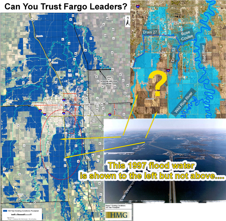
The map in the upper right attempts to show where the natural flood plain would have been, however, the City of Fargo and Cass County modeling doctored the map to reduce the impact area because they plan on leap-frogging into an area that was flooded in previous floods.
Currently underway is a development just north and west of Cass 100 and I29, wherein, an unhealthy economic series of events is unfolding. Shouldn’t development profits within Fargo be invested back into Fargo to benefit the taxpayers that indirectly funded incentives handed to developers in the past?
| Fargo Forum Excerpt: Paces Lodging Corp., the developer of the Commerce on I-29 project, told city leaders more than a year ago that there’s a demand for affordable industrial space that simply can’t be met within city limits where costs are higher. |
Ironically, city and county officials appear to have completely ignored the incompetence of issuing permits for construction before the natural flood plain issues had been addressed.
As per usual…, the Fargo – Cass answer to future flooding issues is always the same.
“FLOOD SOMEONE ELSE!”
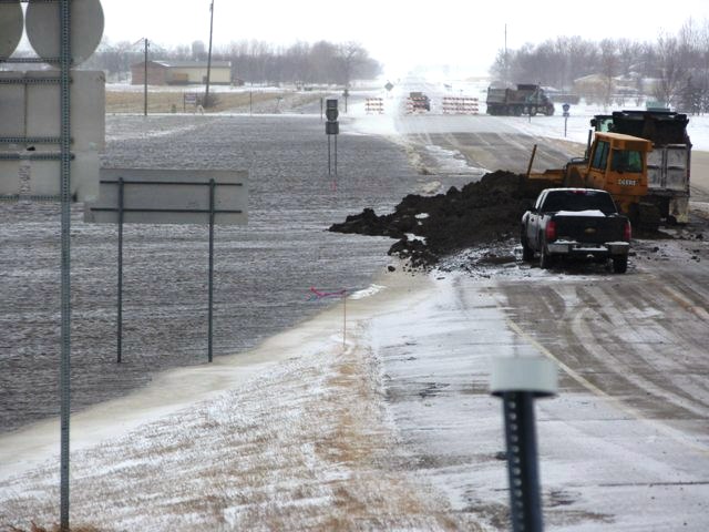
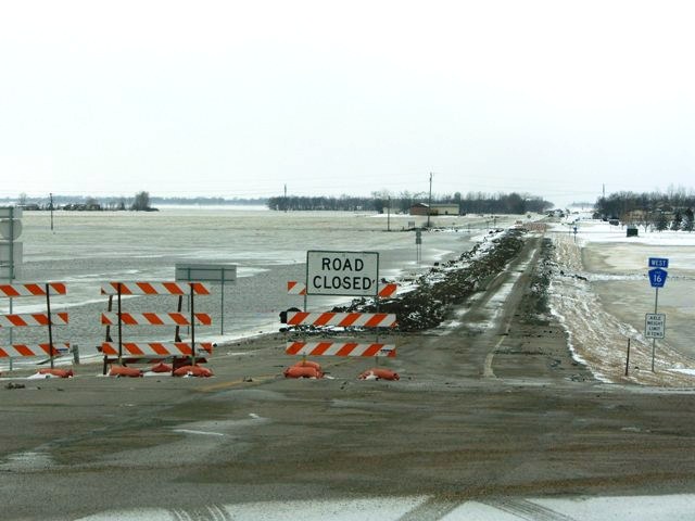
During the 2009, temporary clay dikes were placed on a section of Cass 16 just west of I29, which prevented water from entering the natural flood plain south of Fargo, ND. These dikes held water on property owners upstream and flooded farmsteads and ruined stored crops, where flooding had not previously been a problem.
Since the 2009 flood, Cass 16 and Cass 14 have both receiving thick asphalt overlays to prevent water from entering the natural flood plain south of Fargo.
Fargo continues to grow into high risk areas and the developers don’t want to shoulder flood proofing costs, which would eat into their profits.
When you have Cass and Fargo leaders willing to subsidize high risk natural flood plain development on the backs of taxpayers, the hogs at the trough will never stop squealing for their profits.
No matter how you look at it, the empty suits and talking heads that believe that “the end justifies the means” for Fargo expansion, leaves little doubt that collusion and indirect considerations with a wink and a nod are status quo in Fargo.
Fargo can certainly do better than a Harvard educated hack without an ounce of humility.
…go against market forces…? pfft!
Views: 317