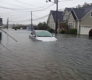
As tropical storm Sandy (downgraded from hurricane) bears down on the eastern United States, one has to feel compassion for the millions of Americans over several states that have to endure tidal storm surges, wind driven rain and snow in excess of 80 mph and flooding from heavy rains.
This is mother nature at her finest…, or worst…, and she always bats last.
If historical records are any indication of what to expect in the aftermath of Super Storm Sandy, the damages will be in the tens of billions.
It begs the question, why would someone want to live there?
Oddly, that is same question many American’s pose to North Dakotan’s. Especially about those who live in Fargo, ND. Those people that pervasively spread fears about flooding…, even during a drought.
When Dennis Millirons (Sanford Health), Don Morton (Microsoft) and Paul Von Ebers (Blue Cross Blue Shield) addressed the North Dakota Legislative Management Water-Related Topics Overview Committee this past April 19, 2012 at the Fargodome, they echoed embellished fears that have been contrived over years to support a theory that Fargo’s economy will wither, we may lose business and other’s may not locate here if excessive multi billion dollar flood protection is not built for the roughly 107,000 Fargo residents that have been irresponsibly developing the last natural flood plain south of I-94.
Is $18,728 – $37,456 per person to protect Fargo residents,
a responsible use of tax dollars in our current economy?
Mayor Dennis Walaker, Darrel Vanyo and his Diversion Authority, Cass (Fargo) commission and the Corps of Engineers are desperate to convince anyone gullible enough to listen that the Fargo Dam and FM Diversion is the linchpin for permanent flood protection. Yet, in reality there is NO permanent flood protection achievable.
Even more asinine is the intentional relocation and concentration of flood risk that could breach and focus damages directly upon Fargo. It would be bitter irony if the construction of the proposed dams and diversion led to a repeat of New Orleans, wherein, a controlled release in 2012 was deemed necessary as a result of “unanticipated consequences” (heavy rain on the wrong side of the structure).
All the fervor, obsession and tax dollars that Fargo and Cass county are pouring into the proposed diversion denotes immaturity and irresponsibly on the part of local officials in pursuit of this project.
The point being…, where is the REAL flood risk?
The Corps of Engineers and Diversion Authority have manipulated potential flood event levels and damage losses in the billions for Fargo’s approximately 107,000 residents. These are the very residents that could receive adequate protection by 2016 for under $300 million. Of course, that is completely contingent upon avoiding further encroachment into regulatory floodways and adjacent flood plains.
By comparison, the densely populated, highly industrialized east coast has suffered three major hurricanes in the past 10 years and a startling five hurricanes have exceeded $3.6 billion in damages since 1989, with hurricane Irene topping the $19 billion dollar mark (not adjusted to inflation) in 2011.
| Year | Event | Rating | Damages |
|---|---|---|---|
| 1989 | Hurricane Hugo | Category 4 | $7,000,000,000.00 |
| 1999 | Hurricane Floyd | Category 2 | $4,500,000,000.00 |
| 2003 | Hurricane Isabel | Category 2 | $3,600,000,000.00 |
| 2004 | Hurricane Charley | Category 4 | $15,113,000,000.00 |
| 2011 | Hurricane Irene | Category 3 | $19,000,000,000.00 |
| 2012 | Hurricane Sandy | Category ? | PENDING |
As the damage loss totals begin to roll in for hurricane (now tropical storm) Sandy, it will be interesting to contemplate how other economic engines, with exposure to greater loss potential, on the east coast will find a way to survive and rebuild…, despite being in an area of greater inherent risk.
Who’s kidding who? Every region of the United States has some form of risk that it faces.
Funding for the proposed Fargo Dam and FM Diversion is dwindling with every natural disaster that befalls the United States.
Maybe it’s time for Fargo, ND and Cass county to understand a fundamental reality that protecting the city that currently exists (not one 50 years from now) with floodwalls and levees with the budget they currently have is what they are going to get.
It would be the height of irresponsibility to allow Fargo to continue encroachment into floodways and flood plains, while simultaneously increasing flood risk to the metro area, when we so thoroughly understand the consequences.
Views: 303

Great Point. There is no completely safe place on earth when it comes to weather.
Considering that we have never faced more than a 50 year event in Fargos recorded history I would say we are pretty darn attractive and safe without any huge federal protection project.
(50 year is how the Diversion authority reclassified 2009 which was previously a 120+ year flood event)